|
|
| Ice storm update |
| By Firefighter Jordan Temple | |
| February 15, 2021 | |
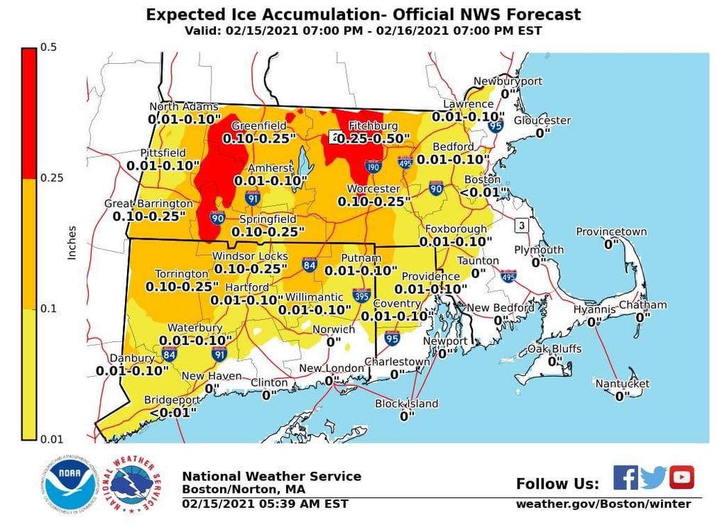
| From the eweather Facebook page. Things are looking a bit better for the first storm this week as modeling thinks the warmer air will push farther inland and that means the highest risk ice zone is smaller and more focused on the CT and MA hills. So that is great news. The second storm this week, Thursday into Friday is trending colder and more impactful with a front end thump of snow followed by sleet and freezing rain and possibly plain rain at the end. |
|
|
|